

Antietam Battlefield, Sharpsburg, Maryland 1862 The true watershed battle of the Civil War. Had Robert E. Lee won, foreign intervention might have resulted in Confederate independence.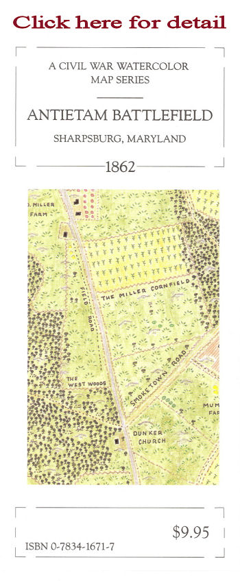
Description: One side of the map features: Morning Antietam Battlefield, Sharpsburg, Maryland 1862 and represents the northern half of the field. The reverse side features: Afternoon Antietam Battlefield, Sharpsburg, Maryland 1862 and represents the southern half of the field. Text: The text includes a monograph describing the Maryland Campaign and the Battle of Antietam.
ISBN: 0-7834-1671-7 New Antietam Product AvailableAntietam Fine Print Civil War Map.An 8 1/2" By 11" map of the Antietam Battlefield prepared by Earl B. McElfresh. Printed on one hundred pound text weight paper. Suitable to be framed. Signed and dated on the back. Packaged in an acrylic sleeve. Priced at $12.95 Copyright ©1999-2013 McElfresh Map Co., LLC. All rights reserved |
![]()
![]()